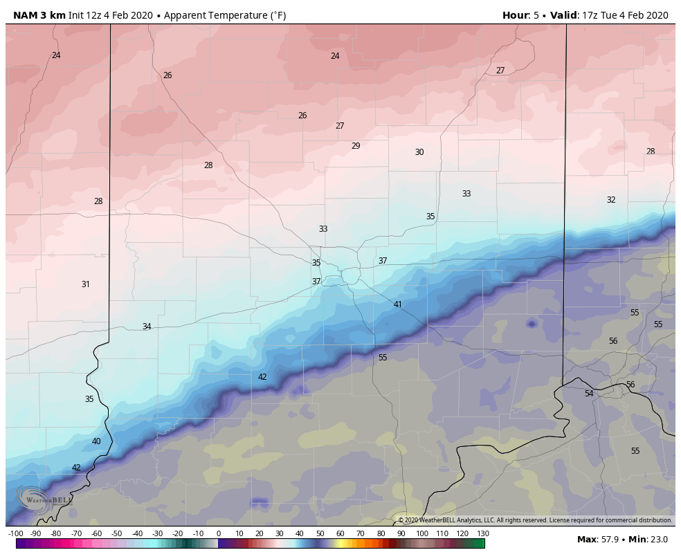
Temps have fallen from 60 since midnight and will continue to sink through the afternoon. One thing rising? Wind speed. Look at these wind chills computer-modeled for 5pm today.
Sleet could start mixing in after about 7pm tonight, with a little snow also possible later.
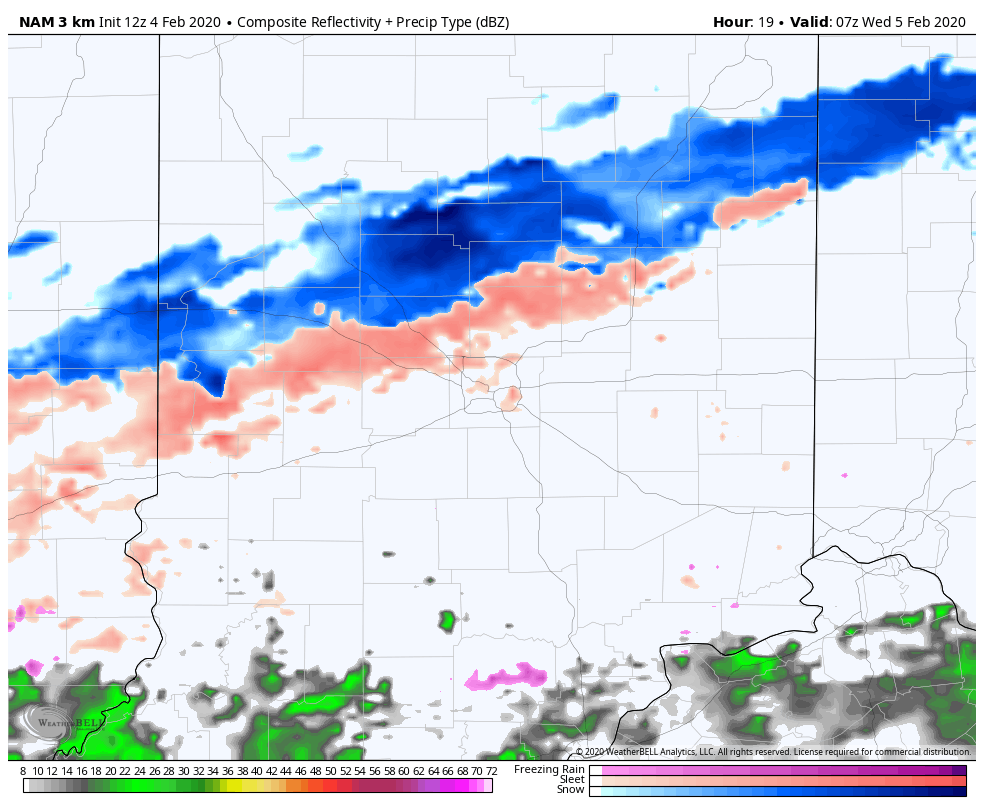
This all comes as a cold front moves south of the state. See that low in Texas tomorrow morning? It will move quickly northeastward, and more mixed precip. is the result from around 3pm Wednesday afternoon through around 10am Thursday morning.
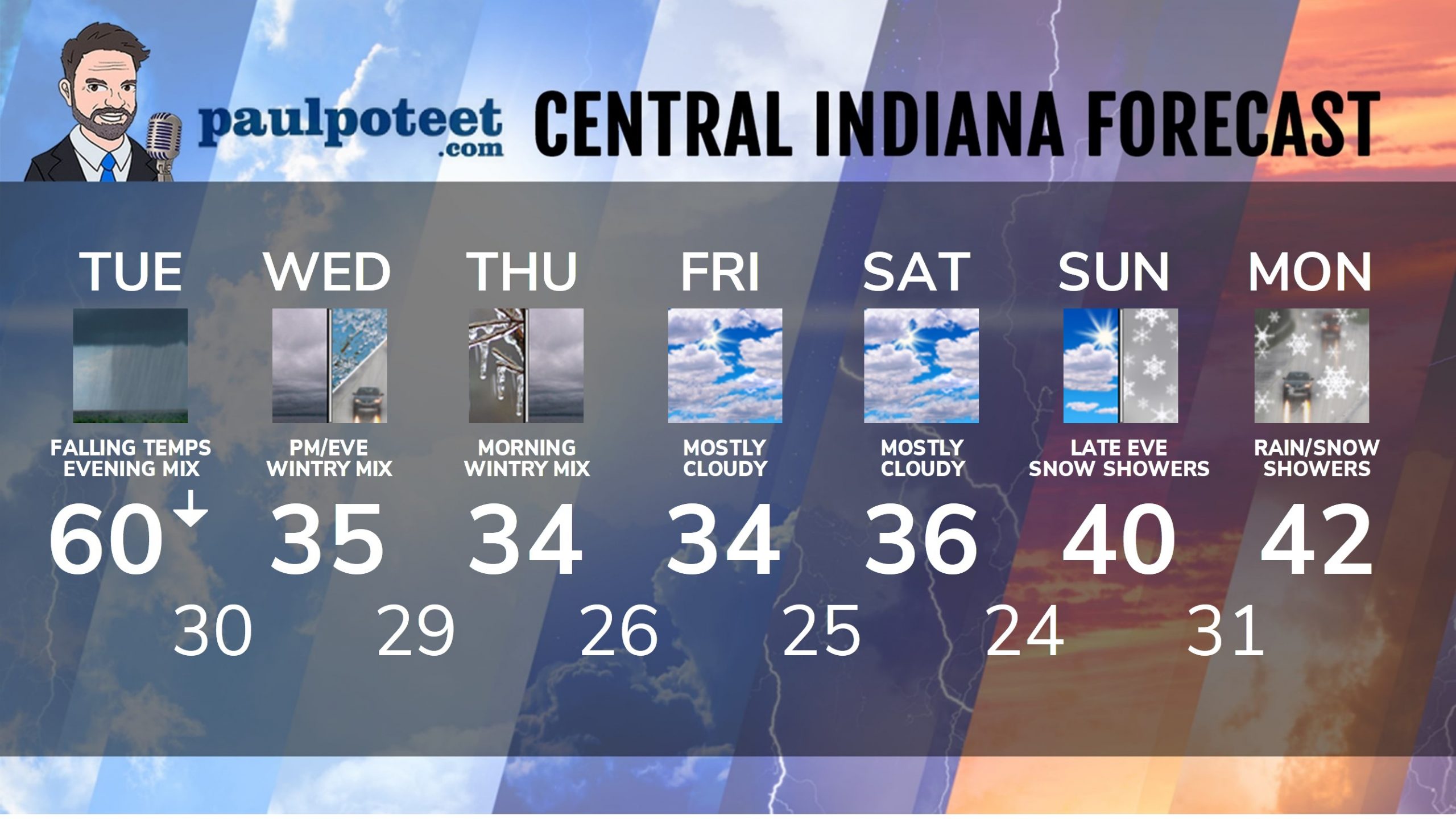
INDY SEVEN DAY FORECAST
Today: Rainy. Temp falls to around the lower 40s by Noon. Wind gusting to 30 mph in the afternoon. Chills around freezing as temps fall into the upper 30s.
Tonight: Rain and a wintry mix of a little snow, sleet, and freezing rain later. Wind gusting to 30 mph. Low 30.
Wednesday: Afternoon rain and sleet. High 35.
Wednesday Night: Wintry mix of sleet and freezing rain, and some snow overnight. Up to an inch of snow and sleet possible. Low 29.
Thursday: Cloudy. Wintry mix of snow, sleet, and freezing rain, mainly in the morning. High 34.
Thursday Night: Mostly cloudy. Low 26.
Friday: Mostly cloudy. High 34.
Friday Night: Mostly cloudy. Low 25.
Saturday: Mostly cloudy. High 36.
Saturday Night: Partly cloudy. Low 24.
Sunday: Partly sunny. High 40.
Sunday Night: Snow showers late. Low 31.
Monday: Snow and rain showers. High 42.
Never miss me! Subscribe for free. My Huge Radar has real-time weather tracking, current temperatures, and severe weather watches and warnings. Get detailed Indiana conditions by clicking here. Click here to see my central Indiana 7-Day Forecast. Follow these links to get my forecasts for Lafayette, Muncie, Hendricks County, and Hamilton County. Need a second opinion? Click here for central Indiana National Weather Service forecasts. (Some charts via WeatherBELL.)


RT @PaulPoteet: Indiana’s Weather For Tuesday: Temps have fallen from 60 since midnight and will continue to sink through the afternoon. Lo…