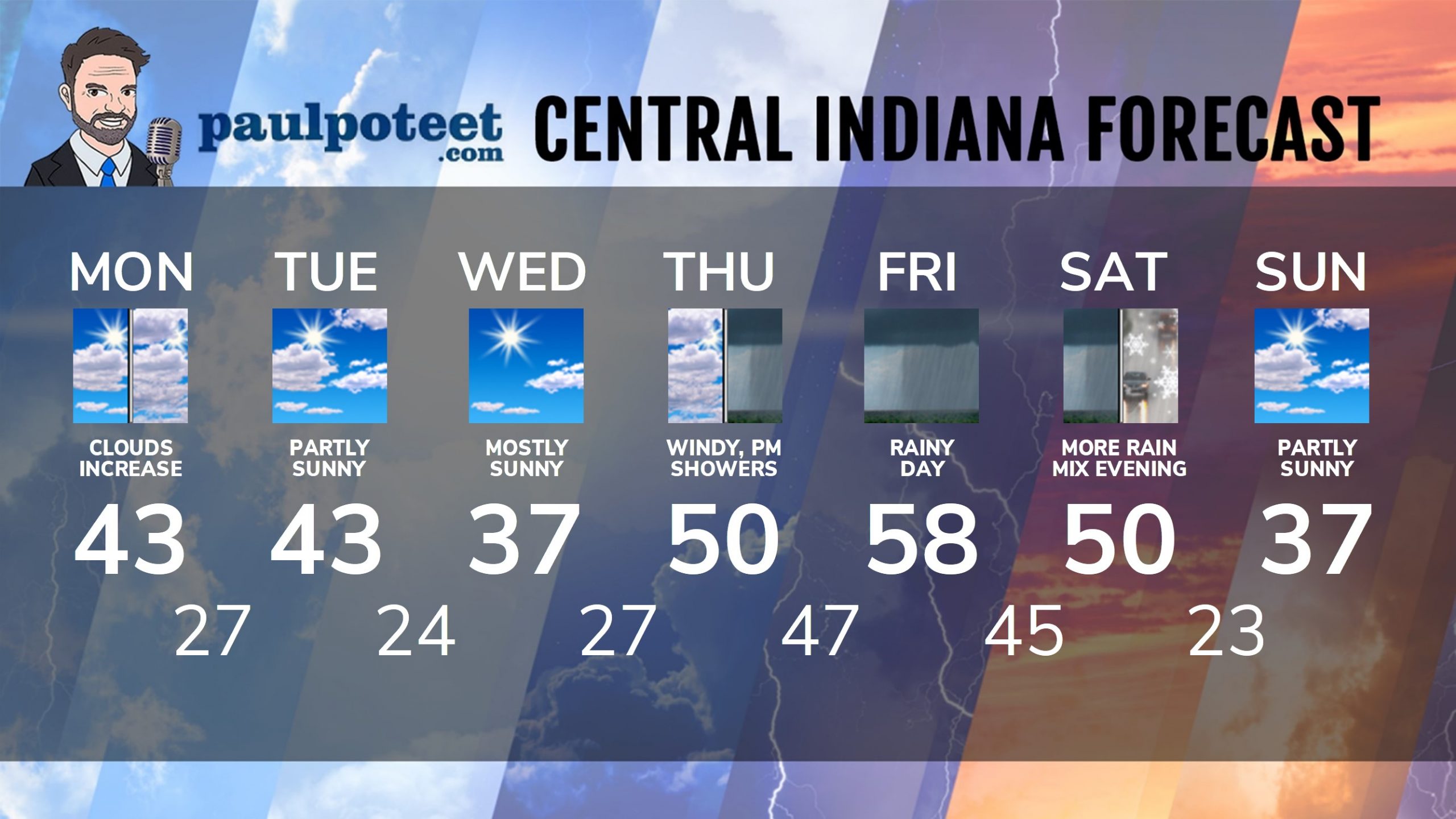
It won’t be as windy today, and it won’t be quite as warm as yesterday, although temperatures will still be above average for the 18th(!) day in a row.
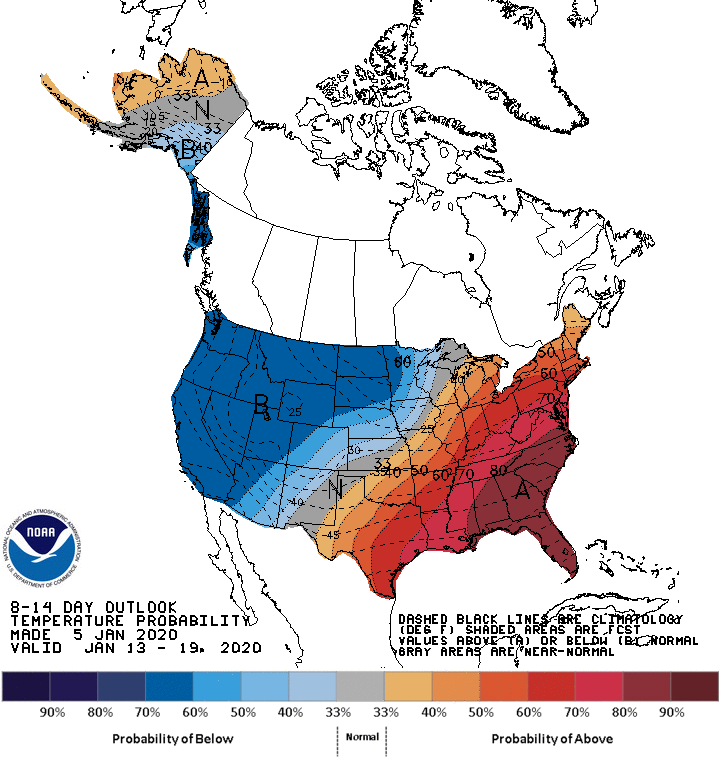
The general temperature trend through January 19th is above average.
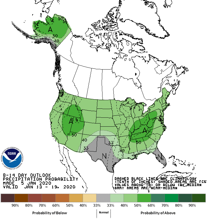
Precipitation also appears above average.
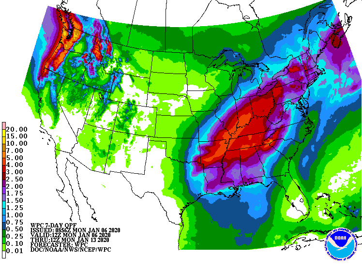
Rainfall late this week could total more than two inches.
INDY SEVEN DAY FORECAST
Today: Becoming partly cloudy. Mostly cloudy by mid-afternoon. High 43.
Tonight: Mostly cloudy. Low 27.
Tuesday: Partly sunny. High 43.
Tuesday Night: Partly cloudy. Low 24.
Wednesday: Mostly sunny. High 37.
Wednesday Night: Mostly clear. Low 27.
Thursday: Cloudy. Wind gusting to 30 mph. Showers begin in the afternoon. High 50.
Thursday Night: Periods of rain. Low 47.
Friday: Rainy. High 58.
Friday Night: Rainy. Low 45.
Saturday: More rain. High 50.
Saturday Night: Rain, mixed with a little snow. Low 23.
Sunday: Partly sunny. High 37.
Never miss me! Subscribe for free. My Huge Radar has real-time weather tracking, current temperatures, and severe weather watches and warnings. Get detailed Indiana conditions by clicking here. Click here to see my central Indiana 7-Day Forecast. Follow these links to get my forecasts for Lafayette, Muncie, Hendricks County, and Hamilton County. Need a second opinion? Click here for central Indiana National Weather Service forecasts. (Some charts via WeatherBELL.)


Indiana’s Weather For Monday
It won’t be as windy today, and it won’t be quite as warm as yesterday, although tem… https://t.co/49SMY3v3Jj
RT @PaulPoteet https://t.co/iU5rMDB7JP https://t.co/sakhXAznwk https://t.co/KIGmKyVwmX