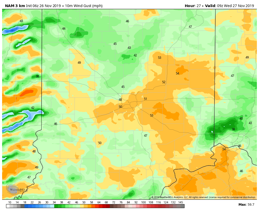
Tie down that inflatable Rudolph, unless you want him to fly early. The wind will gust to 55 mph late tonight and Wednesday. A High Wind Watch is in place for 7am-7pm Wednesday.
Computer-modeled radar shows showers moving in from the west and south. Here are two snapshots, representing 6pm and 10pm tonight.
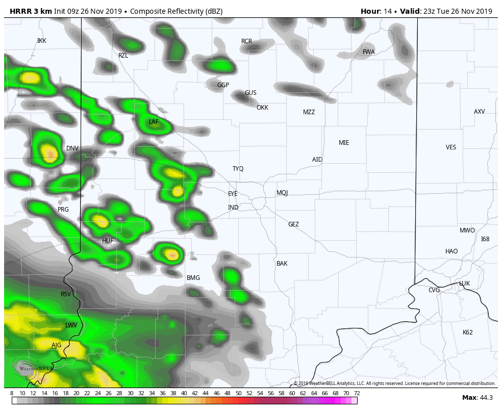
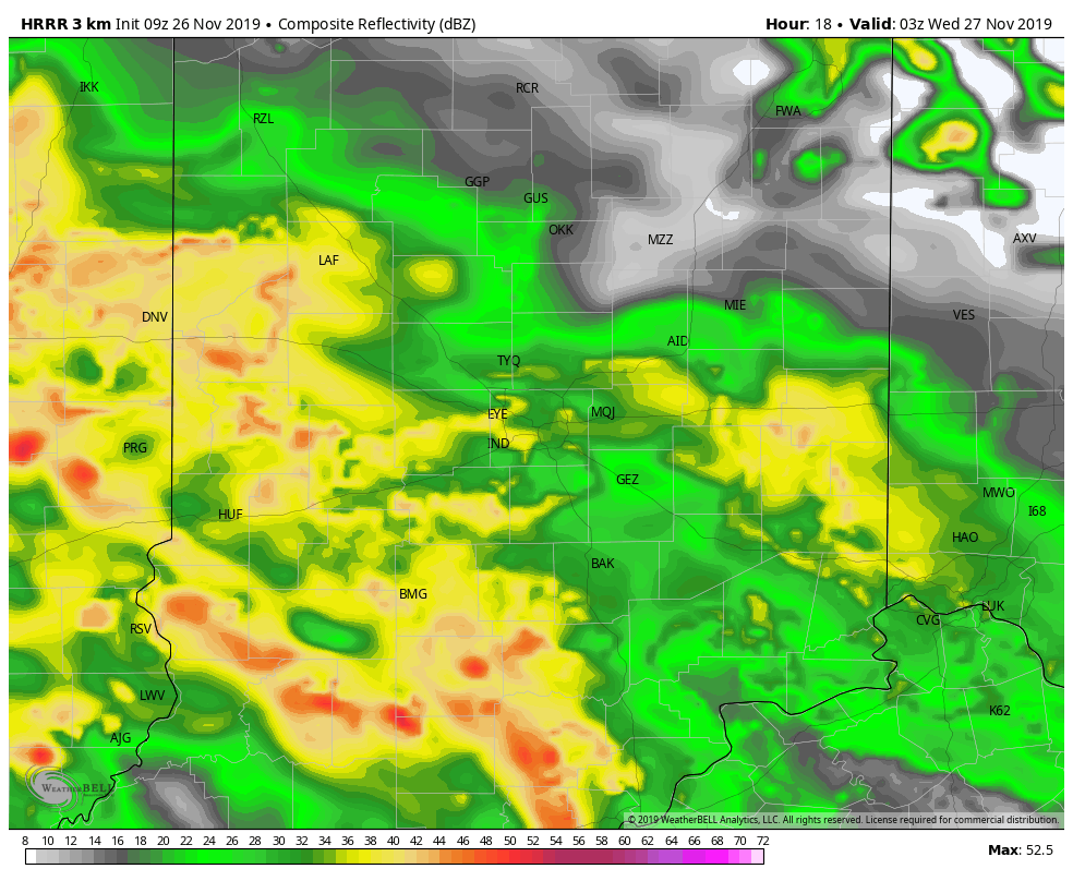
Winds will start whipping after midnight. (Charts via WeatherBELL.)
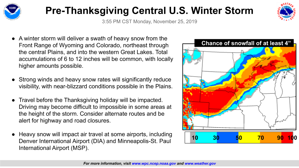
The winds are just a part of a huge storm (as in My Huge Radar) moving across the USA today.
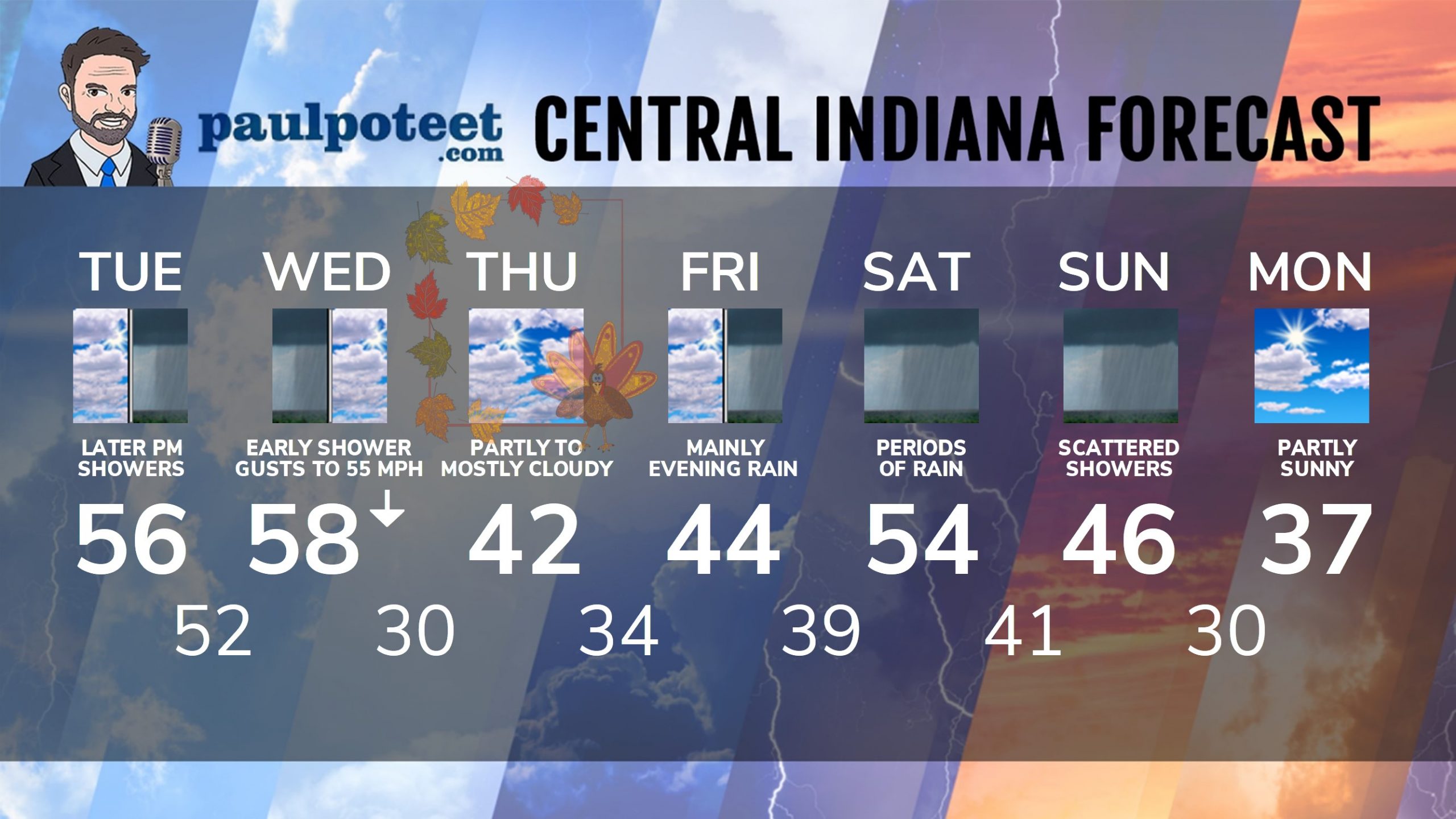
INDY SEVEN DAY FORECAST
Today: Clouds increase. Spotty shower possible in the mid to late afternoon. High 56.
Tonight: Rainy. Wind gusting to 40 mph. Low 52.
Wednesday: Early morning shower chance. Partly to mostly cloudy. Wind gusting to 55 mph! High 58. Temps fall into the 40s by afternoon.
Wednesday Night: Partly cloudy. Wind gusting to 35 mph. Low 30.
Thanksgiving Day: Partly to mostly cloudy. High 42.
Thursday Night: Mostly cloudy. Low 34.
Friday: Cloudy. Spotty showers. High 44.
Friday Night: Rainy. Low 39.
Saturday: Rainy. High 54.
Saturday Night: Rainy. Low 41.
Sunday: Scattered showers. High 46.
Sunday Night: Mostly to partly cloudy. Low 30.
Monday: Partly sunny. High 37.
Never miss me! Subscribe for free. My Huge Radar has real-time weather tracking, current temperatures, and severe weather watches and warnings. Get detailed Indiana conditions by clicking here. Click here to see my central Indiana 7-Day Forecast. Follow these links to get my forecasts for Lafayette, Muncie, Hendricks County, and Hamilton County. Need a second opinion? Click here for central Indiana National Weather Service forecasts. (Some charts via WeatherBELL.)


Indiana’s Weather For Tuesday
Tie down that inflatable Rudolph, unless you want him to fly early. The wind will g… https://t.co/hm4ybWRWDX
RT @PaulPoteet Indiana’s Weather For Tuesday
Tie down that inflatable Rudolph, unless you want him to fly early.… https://t.co/sUId8zeEDa