Snow tonight, severe Tuesday! The former is likely, and the latter is possible in February’s final week. Must be sectional time, right?
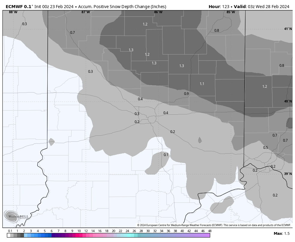
Tonight’s snow will largely be an overnight affair. Here is a look at modeled-totals by daybreak.
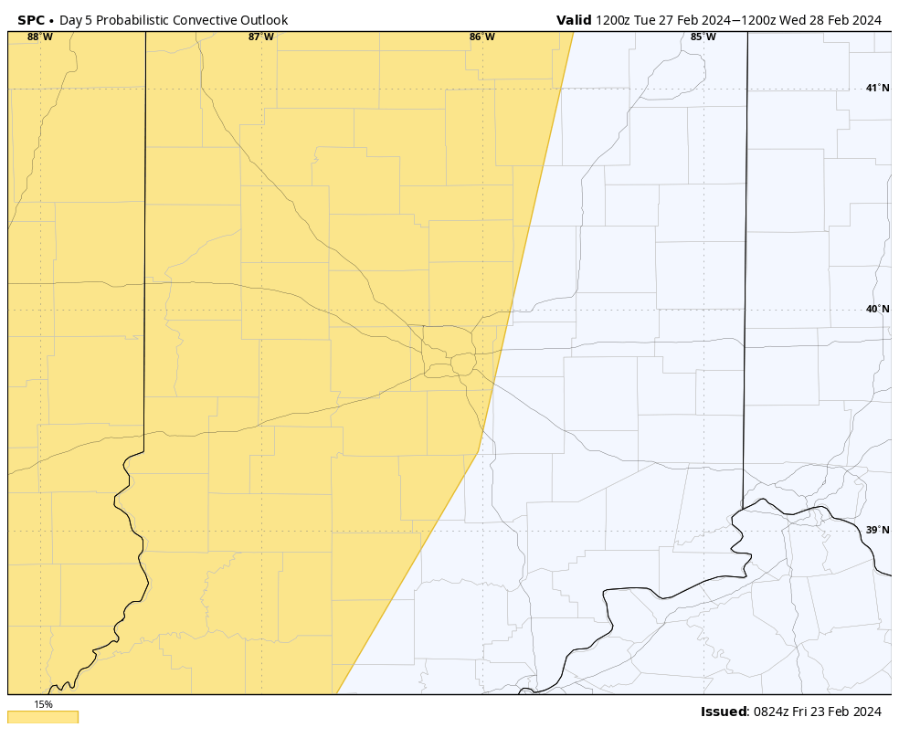
The Storm Prediction Center has some of the state already outlooked for severe weather potential Tuesday.
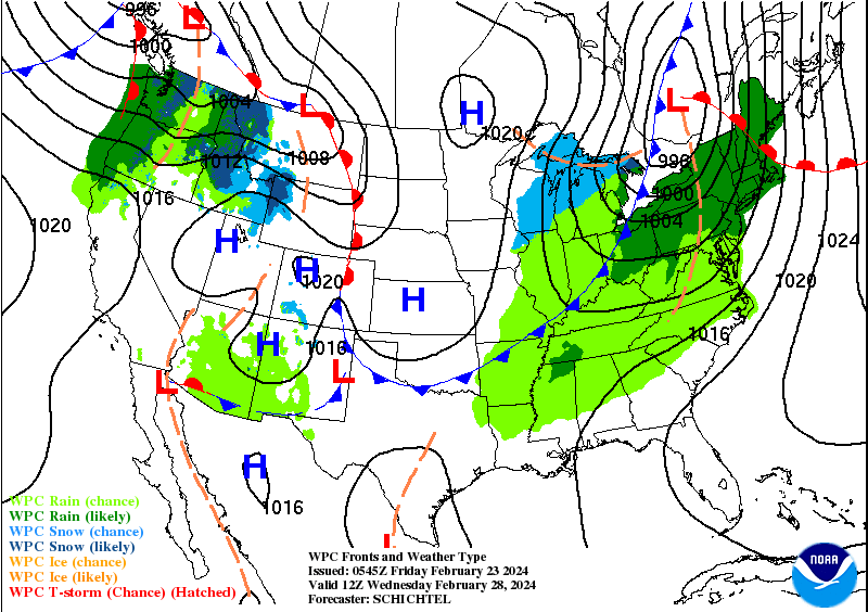
Upper air energy will combine with a surface cold front that should clear the area by 7am Wednesday.
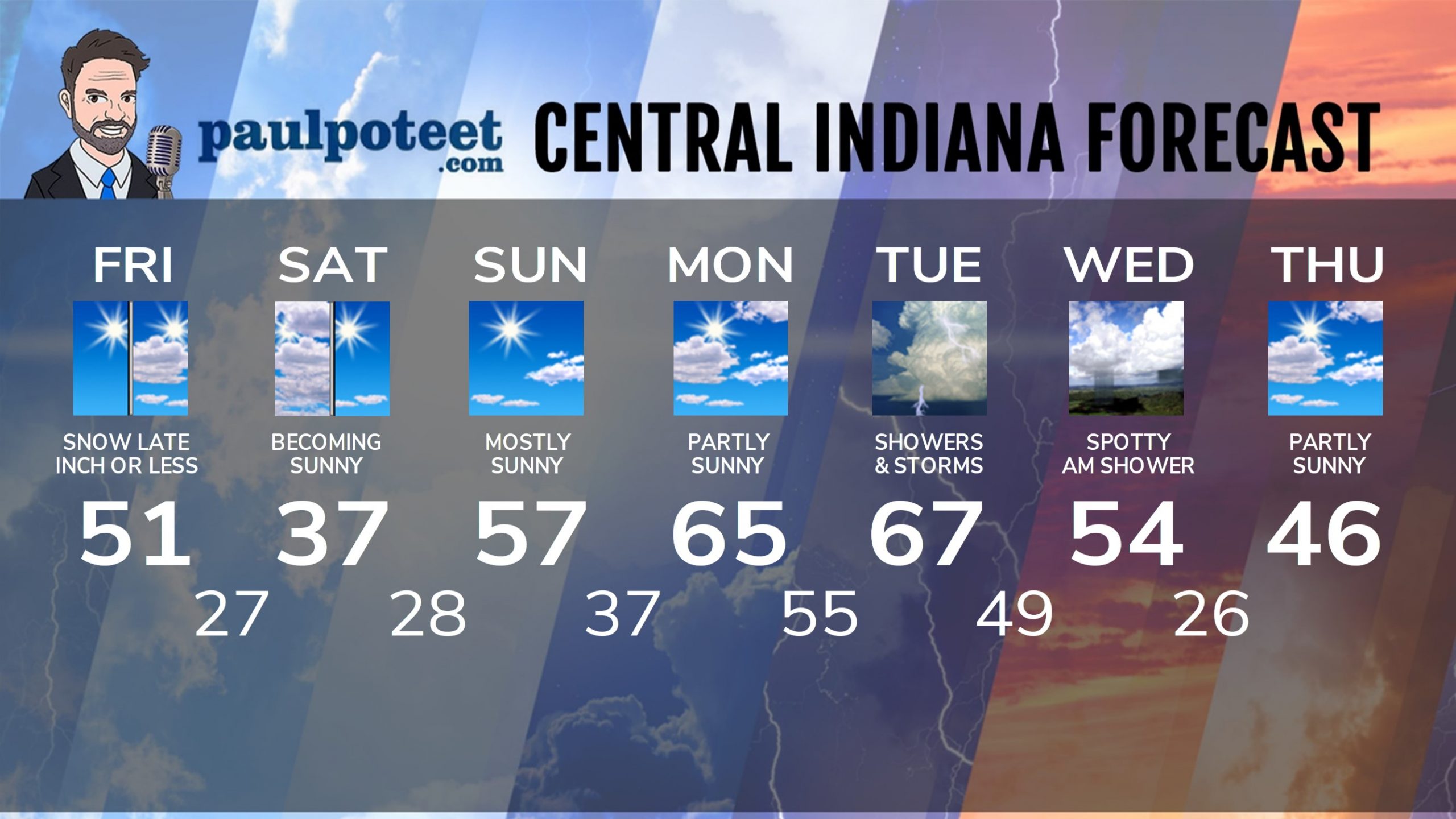
INDY SEVEN DAY FORECAST
Today: Sunny morning. Mostly to partly sunny afternoon. High 51.
Tonight: Clouding up. An inch or less of snow overnight. Snow may begin mixed with rain. Low 27.
Saturday: Snow showers end early morning, then clouds decrease. Sunny by afternoon. High 37.
Saturday Night: Mostly clear. Low 28.
Sunday: Mostly sunny, breezy, and warmer again. High 57.
Sunday Night: Mostly clear. Low 37.
Monday: Partly sunny. High 65.
Monday Night: Clouding up. Scattered showers and storms late. Low 55.
Tuesday: Scattered showers and storms. Some could be strong to severe. High 67.
Tuesday Night: Scattered showers and storms. Some could be strong to severe. Low 49.
Wednesday: Spotty morning shower, then becoming sunny. High 54.
Wednesday Night: Partly cloudy. Low 26.
Thursday: Partly sunny. High 46.
Never miss me! Subscribe for free. My Huge Radar has real-time weather tracking, current temperatures, and severe weather watches and warnings. Get detailed Indiana conditions by clicking here. Click here to see my central Indiana 7-Day Forecast. Follow these links to get my forecasts for Lafayette, Muncie, Hendricks County, and Hamilton County. Need a second opinion? Click here for central Indiana National Weather Service forecasts. (Some charts via WeatherBELL.)


